Utah commercial property due diligence has two title-level issues that buyers from other states regularly miss: water rights are separate from real property in Utah under the prior appropriation doctrine, they do not automatically transfer with the land, and they must be researched separately at the Utah Division of Water Rights; and the Wasatch Fault Zone running through the Salt Lake Valley is one of the most seismically hazardous fault systems in the western US, with documented liquefaction risk across much of the Wasatch Front commercial corridor.
Utah has no state real estate transfer tax on commercial property. Recording fees at the county recorder are nominal - a few hundred dollars for most commercial deeds. This makes Utah one of the lowest acquisition cost states for commercial real estate transfer, alongside Oregon and Nevada.
The Wasatch Front (Salt Lake City, Provo-Orem, Ogden) is one of the fastest-growing commercial real estate markets in the US, driven by tech sector growth (Silicon Slopes), logistics demand from the Union Pacific/I-15/I-80 interchange, and financial services expansion. The Inland Port in northwest Salt Lake City is a major logistics development zone with ongoing infrastructure and zoning complexity.
The Kennecott Utah Copper Superfund site (EPA NPL listing) has documented groundwater contamination across parts of the Salt Lake Valley from the Bingham Canyon Mine operation. Commercial properties in western Salt Lake County should be screened against Kennecott groundwater plume maps before Phase I scoping is finalized.
Set up a Utah due diligence data room before advisors engage. Load ALTA title, Utah Division of Water Rights records, UDEQ ENSTAR records, seismic screening, Wasatch Fault proximity maps, and lease files before diligence opens.
Where Utah property deals go wrong
Not every check carries the same weight. The table below sorts risks by deal impact - dealbreakers first, then what moves the price, then basic hygiene - so your Utah attorney and environmental consultant know what to clear first.
| Area | Documents to pull | UT red flag | Matters most for | Tier | |
|---|---|---|---|---|---|
| Title - county recorder | Title - county recorder | ALTA owner's title commitment, county recorder deed records, ALTA/NSPS survey, UCC fixture search at Utah Division of Corporations | Utah property records are at the county recorder; Utah uses trust deeds for commercial financing; the title examination must separately address water rights (which are NOT part of the real property title); confirm with Utah title insurer whether water rights are being reviewed and whether any appurtenant water rights are specifically insured; a property sold without its water rights in Utah can be commercially worthless in arid areas | All buyers | Dealbreaker |
| Water rights - prior appropriation | Water rights - prior appropriation | Utah Division of Water Rights certificate search (waterrights.utah.gov), water right assignment or change application records, water company share certificates, culinary water connection confirmation | Utah follows the prior appropriation doctrine: 'first in time, first in right'; water rights are personal property (not real property) and do not automatically transfer with a land sale unless specifically included in the purchase agreement and separately assigned; commercial properties dependent on irrigation or process water must confirm that appurtenant water rights are included in the transaction and have been properly assigned; water rights research at the Utah Division of Water Rights (UDWR) is separate from title and is not covered by standard ALTA title insurance | All non-municipal commercial; rural UT especially | Dealbreaker |
| Wasatch Fault - seismic and liquefaction | Wasatch Fault - seismic and liquefaction | Utah Geological Survey fault maps, UGS liquefaction susceptibility maps, structural seismic engineering report for pre-1980 buildings, UGS Quaternary Fault Database | The Wasatch Fault Zone is a 250-mile-long normal fault system running the length of the Wasatch Front from southern Utah to Malad City, ID; a major earthquake on the Salt Lake City segment is estimated at M7.0-7.5 with catastrophic impact on Wasatch Front commercial; the Utah Geological Survey documents liquefaction susceptibility across much of the Salt Lake Valley - areas underlain by lake sediments from ancient Lake Bonneville (the pluvial lake that once covered the valley) are highly susceptible to liquefaction; confirm proximity to fault trace and liquefaction risk zone for all Salt Lake Valley commercial | Salt Lake Valley commercial, all Wasatch Front | Dealbreaker |
| Kennecott Superfund and groundwater plume | Kennecott Superfund and groundwater plume | EPA Kennecott NPL records, Kennecott groundwater plume maps, UDEQ ENSTAR database, Phase I ESA with Kennecott addendum | Kennecott Utah Copper's Bingham Canyon Mine operation has resulted in an EPA Superfund listing (Kennecott South Zone, NPL) with documented groundwater contamination affecting parts of western Salt Lake County; metals and sulfate contamination from mine tailings has migrated in the groundwater; commercial properties in western Salt Lake County should be screened against EPA Kennecott plume maps before finalizing Phase I scope; the remediation is ongoing under EPA oversight | Western Salt Lake County commercial | Dealbreaker |
| Environmental - UDEQ VCP and brownfields | Environmental - UDEQ VCP and brownfields | Phase I ESA (ASTM E1527-21), UDEQ ENSTAR database, UDEQ UST database, Utah Underground Storage Tank program records, EPA ECHO database | Utah DEQ operates a Voluntary Cleanup Program (VCP) providing liability protection for brownfield buyers; a VCP No Further Action (NFA) determination provides regulatory closure for UDEQ-addressed contamination; search UDEQ's ENSTAR database before bidding on any Utah industrial or former-petroleum site; Salt Lake City's industrial areas (northwest Salt Lake City, Midvale, Murray) have documented petroleum and UST contamination from decades of industrial use | Former industrial, Salt Lake City industrial corridor | Price-adjuster |
| Zoning - Utah Inland Port and logistics corridor | Zoning - Utah Inland Port and logistics corridor | Salt Lake City zoning, Utah Inland Port Authority records, SITLA land records, conditional use permit, overlay zone records | The Utah Inland Port Authority (UIPA) oversees a significant logistics development zone in northwest Salt Lake City; commercial land in the UIPA area may be subject to UIPA jurisdiction, development agreements, and zoning overlay requirements that differ from standard Salt Lake City zoning; SITLA (School and Institutional Trust Lands Administration) holds significant land in the Inland Port area; confirm whether the property is within UIPA jurisdiction and what UIPA requirements apply before bidding on northwest SLC industrial | Northwest Salt Lake City industrial, logistics | Price-adjuster |
| Leases and tenancies | Leases and tenancies | All commercial leases, rent roll, estoppel certificates, SNDA agreements, tenant TI allowance and improvement records | Utah tech sector (Silicon Slopes - Lehi, South Jordan, Draper, American Fork) has seen significant lease-up growth; confirm tech tenant lease terms and credit quality; Salt Lake City office has had some post-COVID occupancy adjustments but remains stronger than many western markets; confirm current occupancy and in-place rents against current market for any Salt Lake City office or mixed-use commercial | Silicon Slopes tech office, SLC office | Price-adjuster |
| Federal land adjacency and BLM access | Federal land adjacency and BLM access | BLM land status maps (BLM MLRS), Forest Service records, right-of-way and access permit records, RS 2477 road records | Utah has one of the highest percentages of federally owned land of any US state (~65%); rural and suburban commercial properties may be adjacent to or accessible only through BLM or Forest Service land; access across federal land requires BLM or Forest Service right-of-way permits; RS 2477 roads (pre-1976 public right-of-way claims) are a contested and complex access issue in rural Utah; confirm access is legal and doesn't depend on unpermitted federal land crossings | Rural Utah commercial, resort-adjacent commercial | Price-adjuster |
| No transfer tax - recording fees only | No transfer tax - recording fees only | County recorder recording fee confirmation, deed of trust recording fee | Utah has no state real estate transfer tax; county recording fees for commercial deeds are nominal (typically a few hundred dollars based on page count); Utah mortgage/deed of trust also carries nominal recording fees; total transfer-related closing cost from transfer taxes is effectively zero - a significant advantage over neighboring Colorado (documentary fee of $0.01 per $100 = 0.01% - also very low), Arizona, or Nevada | All buyers | Standard check |
| Insurance - earthquake and air quality | Insurance - earthquake and air quality | Property condition assessment, earthquake insurance quotes, air quality monitoring data, Great Salt Lake dust advisory records | Earthquake insurance is standard for Utah commercial lenders given Wasatch Fault risk; premiums have increased as seismic risk modeling for the Wasatch Front has been updated; Great Salt Lake shrinkage has created documented particulate matter (PM2.5 and PM10) dust hazard from exposed lake bed that affects outdoor commercial operations and construction; confirm air quality impact for any Great Salt Lake-adjacent commercial development | Salt Lake Valley commercial, lakefront commercial | Standard check |
| Seller KYC and AML | Seller KYC and AML | Utah Division of Corporations entity records, UBO identification, FinCEN GTO compliance, OFAC screen | Salt Lake City commercial has attracted significant institutional and international investment (particularly Pacific Rim capital); FinCEN GTOs apply to all-cash purchases in Salt Lake City MSA above threshold; run OFAC and sanctions screens on all principals; confirm Utah Division of Corporations entity records for all selling entities | All deals | Standard check |
Due diligence on a Utah property?
Set up your Ellty data room before diligence starts.
Start free 14-day trialUtah commercial property due diligence checklist
The table ranked risks by severity. This is the full checklist to work through, grouped by area.
Title and water rights - the two separate searches
- Order the ALTA owner's title commitment on day one from a Utah-licensed title insurer; simultaneously initiate the water rights research at the Utah Division of Water Rights (UDWR) - these are two separate processes that must both be completed before closing
- Water rights are personal property in Utah: under Utah's prior appropriation doctrine, water rights are separate from real property and do not automatically transfer with a land sale; the purchase agreement must specifically include the assignment of any appurtenant water rights; water right transfers require an assignment filed with UDWR and, for changes in point of diversion or use, a formal UDWR change application
- UDWR water right search: search UDWR's publicly accessible database (waterrights.utah.gov) for all water rights associated with the property; confirm priority date, source, type of use, volume, and current diversion status; confirm the water right is in good standing and has been used beneficially (water rights not used beneficially can be subject to forfeiture in Utah)
- Water company shares: some Utah commercial properties receive water through water company shares (irrigation companies or mutual water companies) rather than direct UDWR-certificated rights; if the property's water supply comes from a water company, confirm the shares are included in the transaction and that the water company allows the intended commercial use
- Municipal culinary water connection: for urban Utah commercial connected to municipal water (Salt Lake City, Provo, Ogden, etc.): confirm current connection and meter size, adequacy for intended use, and connection fee status; municipal water connection in Utah is based on purchasing connection capacity from the municipality
Give each advisor a scoped link in Ellty. Utah attorney handles title chain and water rights assignment. Environmental consultant handles UDEQ ENSTAR and Phase I/II. Geotechnical engineer handles Wasatch Fault proximity and liquefaction screening. Lender sees UDEQ VCP determination and valuation.
Wasatch Fault - seismic and Lake Bonneville liquefaction
- Pull Utah Geological Survey (UGS) fault maps and liquefaction susceptibility maps for the property location before commissioning Phase I or structural reports
- Wasatch Fault Zone: the Wasatch Fault is a major 250-mile normal fault system; the Salt Lake City segment alone is capable of producing a M7.0-7.5 earthquake; estimated return period for a large (M6.75+) Salt Lake City segment earthquake is approximately 350-400 years; the last major rupture is estimated at approximately 1400 CE; the fault runs through the Wasatch Front urban corridor
- Lake Bonneville sediments and liquefaction: much of the Salt Lake Valley is underlain by fine-grained lake sediments deposited by ancient Lake Bonneville (the pluvial precursor to the Great Salt Lake); these sediments are highly susceptible to liquefaction during seismic shaking; UGS liquefaction susceptibility maps rate large portions of the Salt Lake Valley as moderate to very high liquefaction risk; commercial construction on high-liquefaction-susceptibility soils requires liquefaction mitigation in foundation design
- Structural seismic assessment: for any Utah commercial building constructed before 1975-1980 seismic code updates: commission a structural engineering seismic assessment; unreinforced masonry commercial buildings are common in older Salt Lake City and Ogden commercial areas
- March 2020 Salt Lake City earthquake: a M5.7 earthquake occurred on the Magna fault segment in March 2020 (the largest Utah earthquake in 30 years), causing commercial property damage and confirming seismic risk is active and current, not purely theoretical
Environmental - UDEQ VCP, Kennecott, and USTs
- Commission Phase I ESA meeting ASTM E1527-21 from a UDEQ-familiar environmental professional
- UDEQ ENSTAR database: Utah DEQ maintains the Environmental Notification, Sites, and Technology Assessment Reporting (ENSTAR) database; publicly searchable for contaminated sites, USTs, RCRA generators, and other UDEQ regulatory records; search ENSTAR before bidding on any Utah commercial property with industrial history
- Kennecott Utah Copper groundwater plume: for any commercial property in western Salt Lake County (west of I-215 or near the Jordan River): check EPA Kennecott NPL records and plume maps; the Kennecott South Zone Superfund site has documented metals and sulfate contamination in groundwater from the Bingham Canyon Mine tailings; Phase I should include a specific Kennecott addendum for western SLC commercial
- Utah Voluntary Cleanup Program (VCP): UDEQ's VCP provides regulatory closure for brownfield buyers; a No Further Action (NFA) determination from UDEQ addresses the specific contamination reviewed; the NFA is the standard Utah brownfield lender clearance document; search ENSTAR for VCP status before bidding
- UST contamination: Salt Lake City's older commercial corridors (State Street, 33rd South industrial, Midvale-Murray industrial) have significant UST contamination from former gas stations and auto-related commercial uses; Phase II ESA is standard lender expectation for any former-petroleum or industrial site in these corridors
Load UDEQ ENSTAR records, Phase I/II ESA, Kennecott plume maps, UGS seismic and liquefaction maps, and water rights documents into Ellty. Each advisor gets a scoped, tracked link. Monitor who reviews what - repeated access to Kennecott plume maps or liquefaction zone maps signals where the deal condition will originate.
Water rights - full diligence checklist
- Identify all water rights appurtenant to the commercial property from UDWR records and the purchase agreement
- Confirm water right priority date: in prior appropriation, priority date determines who gets water in shortage; a junior water right (newer priority date) may be curtailed during drought before senior rights are affected; confirm the priority date is adequate for the intended commercial use
- Confirm water right status: active (not forfeited or abandoned), certificated (final UDWR certificate issued, not just application pending), and adequate for the volume and use type needed for the commercial operation
- Water right assignment: confirm the purchase agreement specifically assigns the water rights; the assignment must be filed with UDWR; if the water right requires a change in point of diversion or place of use for the new owner's commercial use, a formal change application must be filed with UDWR and approved - this process can take 12-36 months
- Irrigation company shares: if the property's water comes through an irrigation company, confirm shares are included in the transaction, that the company allows the intended commercial use, and that annual assessments are current
- Great Salt Lake decline: ongoing decline of the Great Salt Lake has increased competition for water rights in the Great Salt Lake watershed; confirm that any water right from a Great Salt Lake tributary source has not been curtailed or is not subject to ongoing state water right calls
Federal land, BLM access, and SITLA
- For any commercial property in rural or suburban Utah: check BLM Master Lease Repository System (MLRS) and BLM land status maps to determine federal land ownership adjacent to or providing access to the commercial parcel
- BLM right-of-way permits: commercial access across BLM land requires a valid BLM right-of-way (ROW) permit; unpermitted access roads across BLM land are illegal and can be revoked; confirm any access road crossing BLM land has a current ROW permit adequate for the intended commercial use
- SITLA lands: the Utah School and Institutional Trust Lands Administration (SITLA) manages approximately 3.3 million acres of trust lands in Utah (primarily in rural areas); commercial properties adjacent to SITLA land may have SITLA access easements, mineral rights reservations, or other SITLA interests recorded in the title chain
- RS 2477 roads: pre-1976 public right-of-way claims under Revised Statute 2477 are a complex and contested issue in rural Utah; some commercial properties depend on RS 2477 road access whose public status is disputed between Utah counties and the federal government; confirm access route legal status with Utah counsel before relying on RS 2477 roads
Utah Inland Port and northwest Salt Lake City zoning
- For any northwest Salt Lake City commercial property: confirm whether it's within the Utah Inland Port Authority (UIPA) geographic boundary
- UIPA jurisdiction: the Utah Inland Port Authority Act created UIPA to oversee development in a roughly 15-square-mile area in northwest Salt Lake City; UIPA has authority over a project area and certain tax increment financing; commercial development within the UIPA area may be subject to UIPA master plan requirements, UIPA development agreements, and special zoning
- SITLA land within UIPA: SITLA owns significant acreage within the UIPA boundary; commercial transactions involving SITLA land within UIPA require understanding of both SITLA lease and disposition processes and UIPA requirements
- Great Salt Lake proximity: commercial development near the Great Salt Lake shoreline faces additional complexity from state ownership of the lake bed (Utah Division of State Lands), potential lake level fluctuation affecting shoreline location, and Great Salt Lake dust/air quality impacts from the shrinking lake
Compare Colorado's commercial property due diligence process when running Mountain West portfolio acquisitions. Utah and Colorado share prior appropriation water rights systems (critical for rural commercial) and significant federal land adjacency, but differ on transfer taxes (UT: $0 vs. CO: very low documentary fee), seismic risk (UT Wasatch Fault is higher risk than most of Colorado), and environmental brownfield programs (UT UDEQ VCP vs. CO CDPHE VCP).
How due diligence works in Utah
Step 1 - Title, water rights, and seismic screening
Day one: order ALTA title commitment and simultaneously initiate water rights research at UDWR. These run in parallel - do not wait for one before starting the other.
Pull UGS fault proximity and liquefaction susceptibility maps immediately to inform Phase I scope and structural assessment needs. For western Salt Lake County: check EPA Kennecott NPL plume maps before commissioning Phase I scope.
Search UDEQ ENSTAR for any contamination records. Confirm whether property is within UIPA boundary (northwest SLC industrial).
Step 2 - Seismic structural, environmental, and water rights
Commission Phase I ESA with UDEQ ENSTAR databases and Kennecott addendum (if western SLC). For any commercial building constructed before 1980: commission structural seismic assessment in parallel - don't wait for Phase I.
Complete water rights research: confirm UDWR certificate status, priority date, volume, and use type. Confirm all appurtenant water rights are included in the purchase agreement. For any rural commercial with irrigation water: confirm company share status and adequacy.
Step 3 - BLM access, UIPA, and leases
For rural Utah: confirm BLM ROW permit status for any access roads crossing federal land. Check SITLA adjacency.
Confirm zoning and UIPA jurisdiction (northwest SLC). Abstract all leases. Model earthquake insurance premium - standard for Utah commercial lenders.
Step 4 - No transfer tax, closing costs
Utah has no real estate transfer tax; calculate only nominal county recording fees. Standard Utah commercial diligence: 45-60 days. UDEQ VCP brownfield: 12-24 months for NFA. Water right change application: 12-36 months if use change is required.
Load all files into Ellty before advisors engage. Title attorney gets ALTA and water rights chain. Environmental consultant gets UDEQ ENSTAR, Kennecott maps, and Phase I/II. Structural engineer gets UGS seismic/liquefaction maps and building records. Water rights attorney gets UDWR certificates. Lender gets UDEQ NFA and valuation.
How to set up your Utah data room in Ellty.
UT commercial deals involve ALTA title, UDWR water rights records, UDEQ ENSTAR records, Kennecott plume maps, UGS seismic and liquefaction maps, BLM access permits, and lease files. Load everything before advisors arrive.
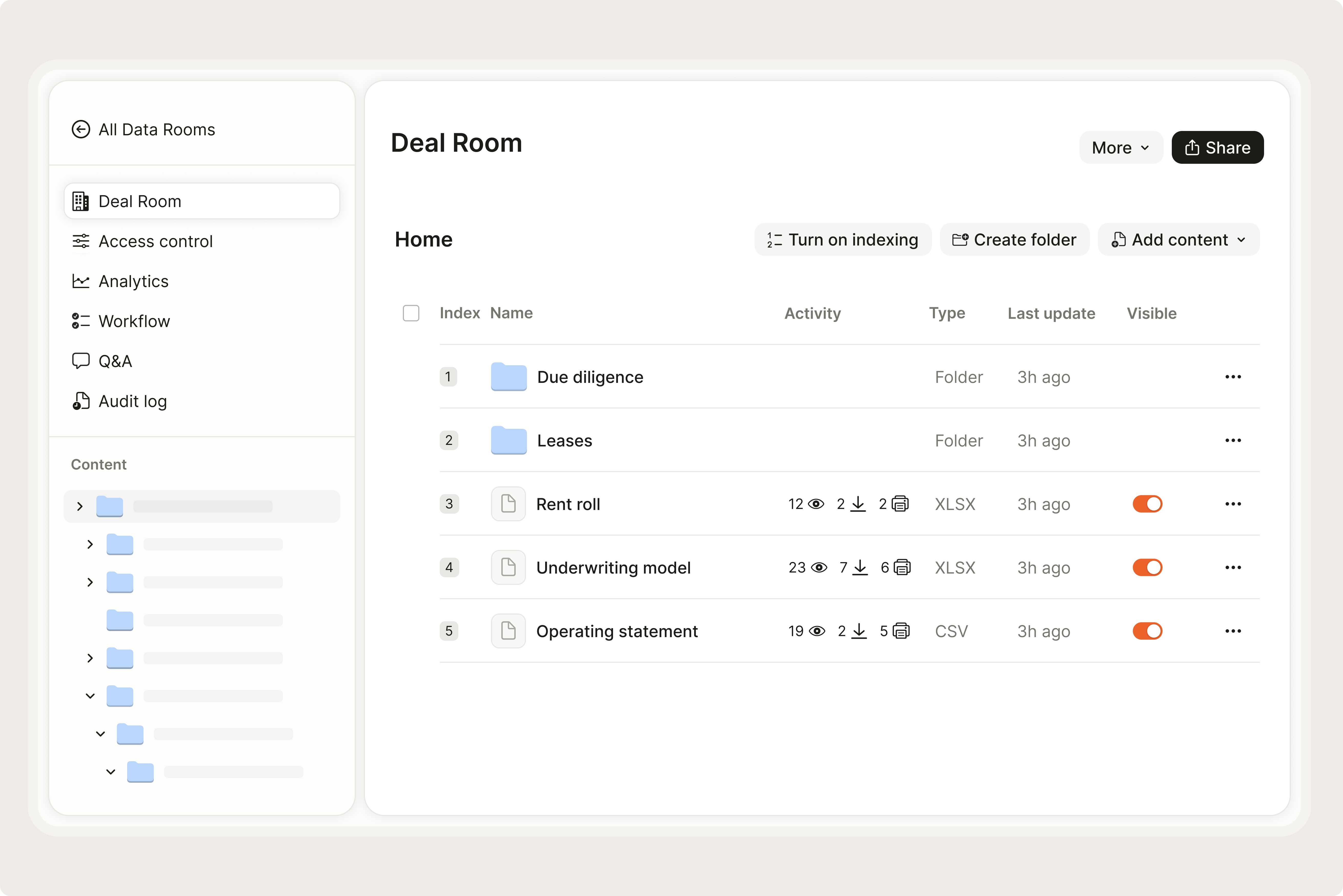
- 1.Upload Utah property files to a secure roomDrop ALTA title, UDWR water rights certificates, UDEQ ENSTAR records, Phase I ESA, UGS fault and liquefaction maps, Kennecott plume maps, BLM ROW permits, and lease pack into Ellty.
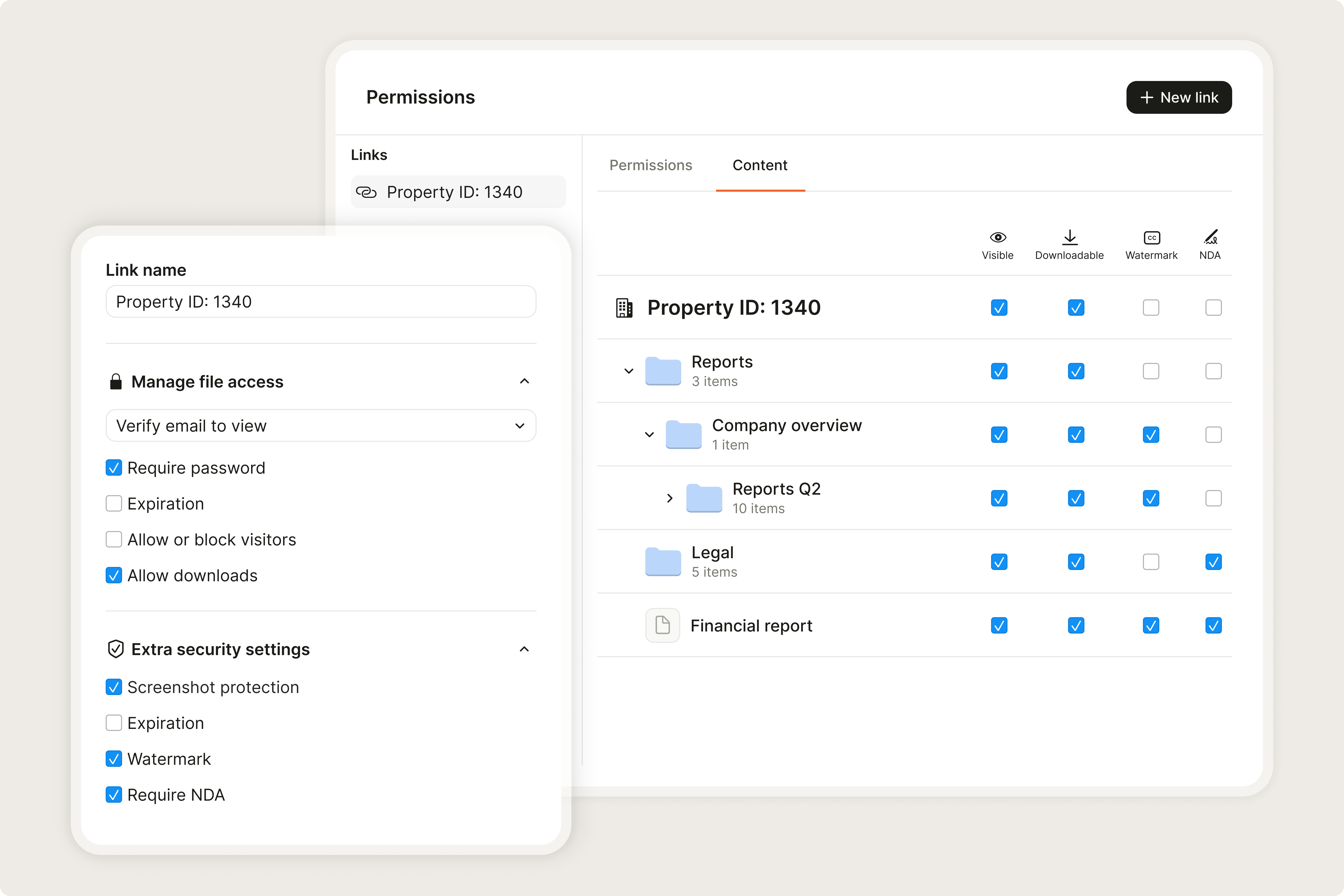
- 2.Give each advisor a scoped, tracked linkUtah attorney sees title chain and water rights records. Environmental consultant sees UDEQ ENSTAR, Kennecott maps, and Phase I/II. Structural engineer sees UGS seismic data. Water rights attorney sees UDWR certificates. Lender sees UDEQ VCP NFA and valuation.
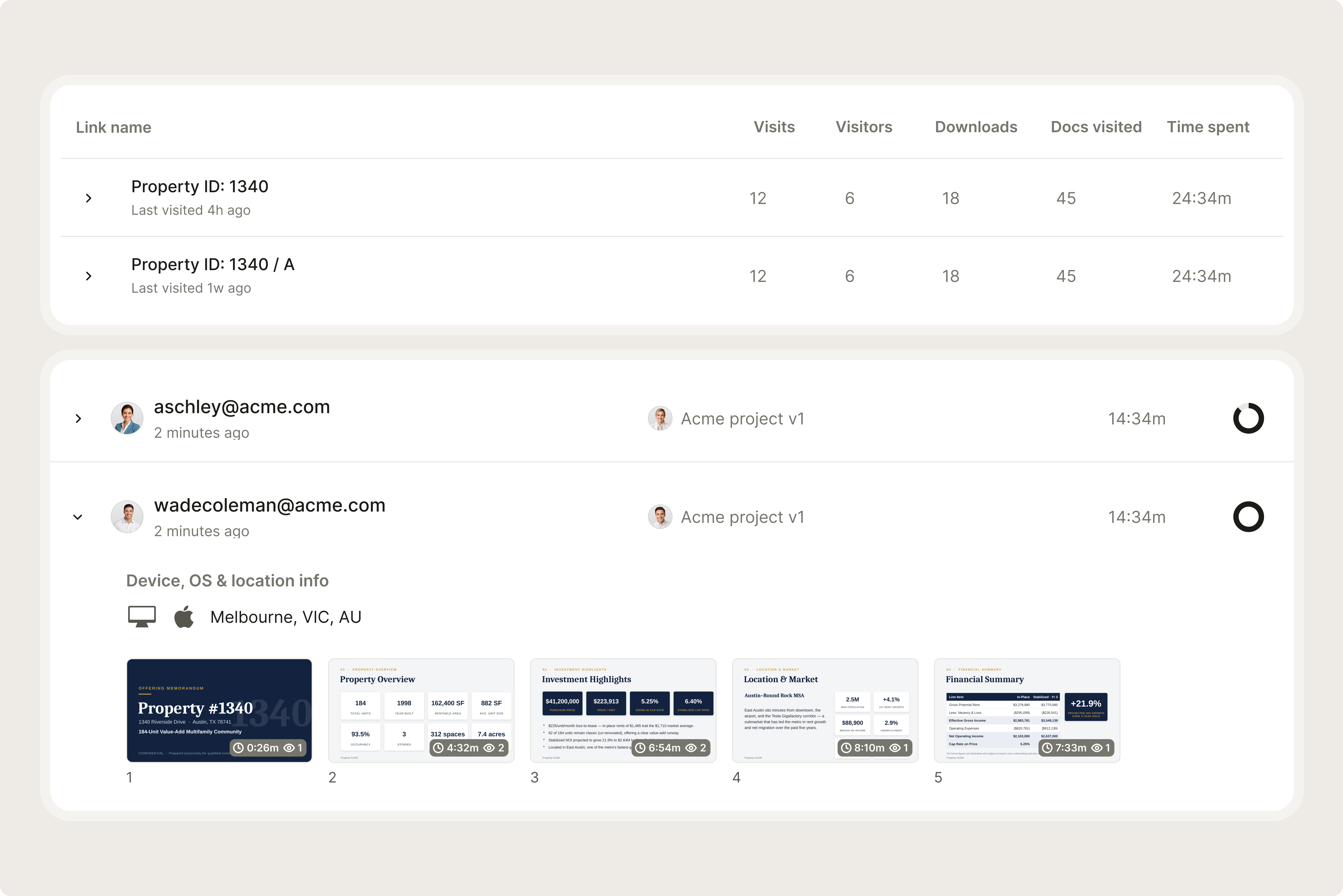
- 3.Monitor who reviews which documentsSee exactly which files each advisor opened and when. Catch water rights deficiencies or Wasatch Fault seismic concerns before they affect deal pricing or closing.
What makes Utah different
Water rights are the Utah commercial title issue that out-of-state buyers miss most consistently - because in most US states, water rights are either irrelevant (municipal water from a utility) or automatically included with land. In Utah, they're neither. Water rights are personal property under Utah law, they're managed by the Utah Division of Water Rights under the prior appropriation doctrine, and they transfer separately from the real property deed. A Utah commercial purchase agreement that doesn't specifically address water right assignment may not transfer the water rights the buyer assumed were included. For commercial properties that depend on water for industrial processes, irrigation, or resort operations, this is a dealbreaker-level issue. The UDWR water rights research must run in parallel with title - not after the Phase I delivers.
The Wasatch Fault liquefaction risk is underestimated in most standard commercial diligence. The fault itself gets attention, but the broader liquefaction risk across the Salt Lake Valley - driven by the ancient Lake Bonneville lake sediments that underlie most of the valley floor - affects commercial properties far from the fault trace itself. A commercial building 5 miles from the Wasatch Fault in western Salt Lake Valley may sit on extremely high liquefaction susceptibility soils that could experience major ground failure in a M7.0 earthquake. Foundation design for liquefaction mitigation (deep pilings, soil improvement, or structural grade beams) adds significant cost to commercial construction. The March 2020 M5.7 earthquake near Magna reminded the market that seismic events on the Wasatch system are current reality, not historical speculation.
The Kennecott Superfund situation in western Salt Lake County is ongoing - the EPA's Kennecott North and South Zone sites include documented groundwater contamination from over a century of copper mining operations at Bingham Canyon. The contamination plume has migrated in the groundwater across portions of western Salt Lake County. For commercial properties in this area (roughly west of I-215, near the Jordan River corridor, or in the Copperton/Herriman area), the Kennecott plume maps should be reviewed before finalizing Phase I scope. This is not a reason to avoid western SLC commercial - the Kennecott cleanup is active and real estate transactions in the area happen regularly - but it is a reason to understand what you're dealing with before bidding.
Utah water law is based on the prior appropriation doctrine, codified in Utah Code Ann. § 73-1-1 et seq. Under prior appropriation, water rights are personal property separate from real property, allocated by priority date (first in time, first in right), and usable only for beneficial uses specified in the water right certificate. Water rights do not transfer automatically with a real property deed; they must be specifically conveyed by separate assignment to the Utah Division of Water Rights (UDWR). A change in point of diversion, place of use, or type of use requires a formal change application filed with UDWR and approved by the State Engineer, a process that typically takes 12-36 months. UDWR maintains a public database of all certificated and pending water rights, accessible at waterrights.utah.gov. Water rights research is separate from ALTA title insurance, which does not insure water rights unless specifically endorsed.
Timeline and cost in Utah
Weeks 1-2 cover kickoff: ALTA title commitment order, UDWR water rights search and analysis, UGS fault and liquefaction map review, EPA Kennecott plume check (western SLC), UDEQ ENSTAR search, Phase I ESA commission (with UDEQ-specific databases), structural seismic assessment commission (pre-1980 buildings), BLM land status check (rural/federal-adjacent), UIPA boundary confirmation (northwest SLC industrial), zoning confirmation, and lease abstraction initiation. Legal fees in this phase: USD 5,000-20,000.
Load all files into Ellty before advisors engage. Standard Utah commercial: 45-60 days. UDEQ VCP NFA: 12-24 months. Water right change application: 12-36 months.
Weeks 2-6 cover deep review: Phase I ESA delivery, UDEQ VCP status confirmation, structural seismic assessment delivery, water rights analysis completion (UDWR certificate review), BLM ROW permit confirmation, UIPA jurisdiction and requirements, liquefaction risk assessment, zoning compliance, lease abstraction, and earthquake insurance quotes. Costs in this phase: USD 10,000-35,000.
Weeks 6-12 handle resolution: Phase II ESA (if triggered), UDEQ VCP enrollment (brownfield), water right change application (if use change needed), foundation liquefaction mitigation design (if high liquefaction zone), title exception clearance, and closing preparation.
Utah total buyer acquisition costs for commercial: ALTA title insurance + water rights research + legal/advisory + environmental (Phase I/II) + seismic structural assessment + no transfer tax + nominal recording fees. Total acquisition overhead is among the lowest in the western US from a transfer tax standpoint.
Running a Utah property deal from one room
Hold ALTA title, UDWR water rights records, UDEQ VCP docs, seismic reports, and lease files in one secure, tracked Ellty data room.
Start free 14-day trialCommon questions about due diligence on Utah commercial property
- Standard Utah commercial deals take 45-60 days. UDEQ Voluntary Cleanup Program (VCP) brownfield clearance: 12-24 months for a No Further Action determination. Water right change application (if a change in use or point of diversion is needed): 12-36 months for UDWR approval. Pre-1980 buildings requiring structural seismic assessment and liquefaction mitigation design: add 4-6 weeks. Rural commercial requiring BLM right-of-way permit confirmation and SITLA review: add 2-4 weeks.
- No. Water rights are personal property in Utah under the prior appropriation doctrine and do not automatically transfer with a real property deed. The purchase agreement must specifically include assignment of any appurtenant water rights, and the assignment must be filed with the Utah Division of Water Rights (UDWR). A change in how the water is used (different point of diversion, different place of use, or different type of use) requires a formal UDWR change application and approval - a 12-36 month process. Research water rights at UDWR (waterrights.utah.gov) as a separate parallel track alongside ALTA title research.
- The Wasatch Fault Zone is a 250-mile normal fault system running through the Salt Lake Valley. The Salt Lake City segment is capable of producing a M7.0-7.5 earthquake. Additionally, much of the Salt Lake Valley is underlain by ancient Lake Bonneville sediments that are highly susceptible to liquefaction during seismic shaking - this risk extends well beyond the immediate fault zone. Commission structural seismic assessment for pre-1980 Utah commercial buildings. Pull Utah Geological Survey fault proximity and liquefaction susceptibility maps before finalizing Phase I or structural assessment scope. Earthquake insurance is standard for Utah commercial lenders.
- Kennecott Utah Copper's Bingham Canyon Mine operation created an EPA Superfund listing (Kennecott North and South Zones, NPL) with documented groundwater contamination from mine tailings in western Salt Lake County. The contamination plume has migrated in groundwater across portions of western Salt Lake County near the Jordan River corridor. Commercial properties in western Salt Lake County (roughly west of I-215) should be screened against Kennecott plume maps before finalizing Phase I scope. The Kennecott cleanup is active and ongoing under EPA oversight.
- No. Utah has no state real estate transfer tax. County recording fees are nominal (typically a few hundred dollars based on page count). There is no Utah mortgage recording tax equivalent either. Utah commercial buyers pay only nominal county recording fees at closing - one of the lowest acquisition cost structures of any US commercial real estate market.
- The Utah Inland Port Authority (UIPA) was created by the Utah Inland Port Authority Act to oversee development in approximately 15 square miles of northwest Salt Lake City. UIPA has authority over project area development, certain tax increment financing, and master planning. Commercial properties within the UIPA boundary may be subject to UIPA requirements, development agreements, and special zoning in addition to standard Salt Lake City zoning. SITLA (School and Institutional Trust Lands Administration) owns significant acreage within the UIPA boundary. Confirm UIPA jurisdiction before bidding on northwest SLC industrial or logistics commercial.